Use Cases
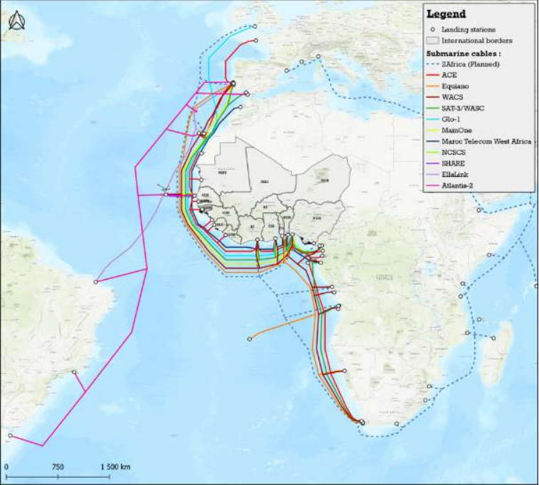
For an international funding institution, Capacity Supply, Demand and Needs and Data Infrastructure Assessment for 16 West African countries
The study aimed at identifying solutions that would enable the optimization of national and regional data capacity infrastructure to tailor to the incoming growing demand in selected West African countries:
- Identify infrastructure investment gaps (both submarine and terrestrial) to increase access to and transmission of international capacity to the ECOWAS and Mauritania countries;
- Identify data infrastructure investment gaps to increase cross-regional data flows with special focus on landlock countries;
- Identify options to fill the missing gaps focusing on crowding-in and maximizing private investments, including by leveraging other utilities infrastructure (e.g., energy, railways);
- Identify regulatory bottlenecks and provide recommendations to optimize public-private investments.

For the WAEMU Commission, evaluation of the ICT market in 8 countries and inventory of the use of digital services and national digital policies
The main objective was to assess the use of digital services by businesses and populations in different sectors: agriculture, health education, trade and administration and to analyze national policies & regulations on digital technologies in WAEMU Member States.
- Assessment of the infrastructure and digital services in each member of the WAEMU
- Overview of the legal and regulatory framework in and each country of the WAEMU
- Identification of the technical and legal obstacles to the harmonized development of digitized services in the WAEMU area
- Recommendation of services to be offered to businesses and populations by public administrations
- Propose actions to be implemented, by the Commission and the Member States, for a wider offer and use of digital services
- Propose a preliminary draft of regulatory texts to regulate the supply of digital services, promote digital service providers and strengthen public confidence in the use of digital services
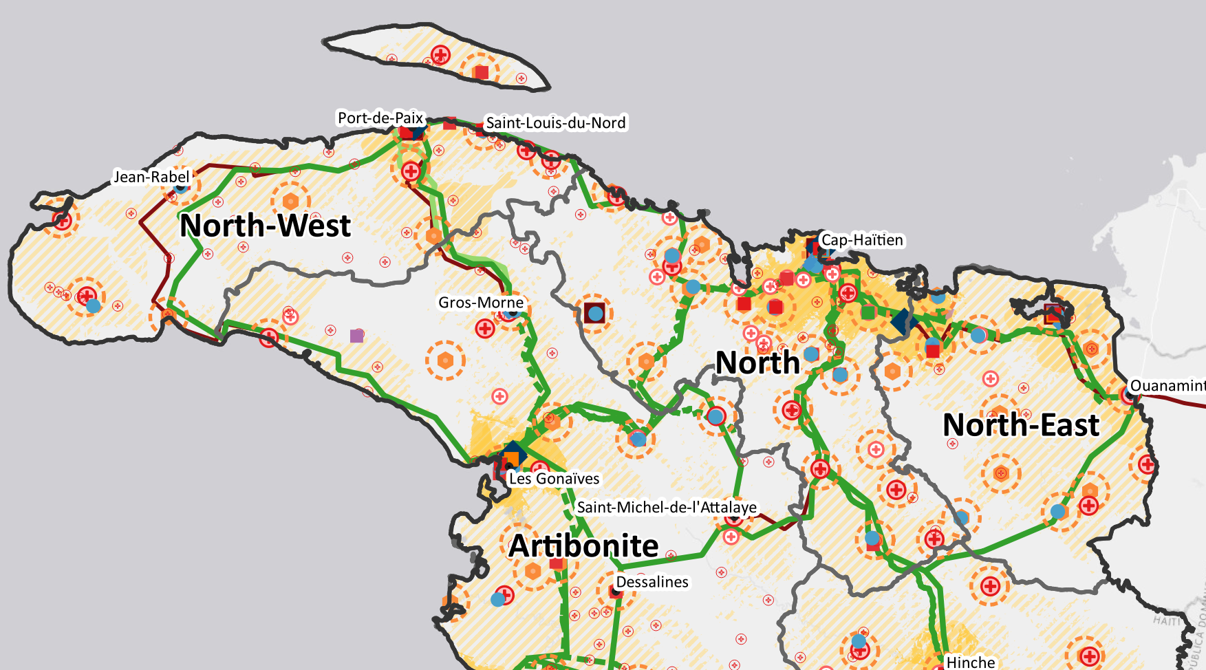
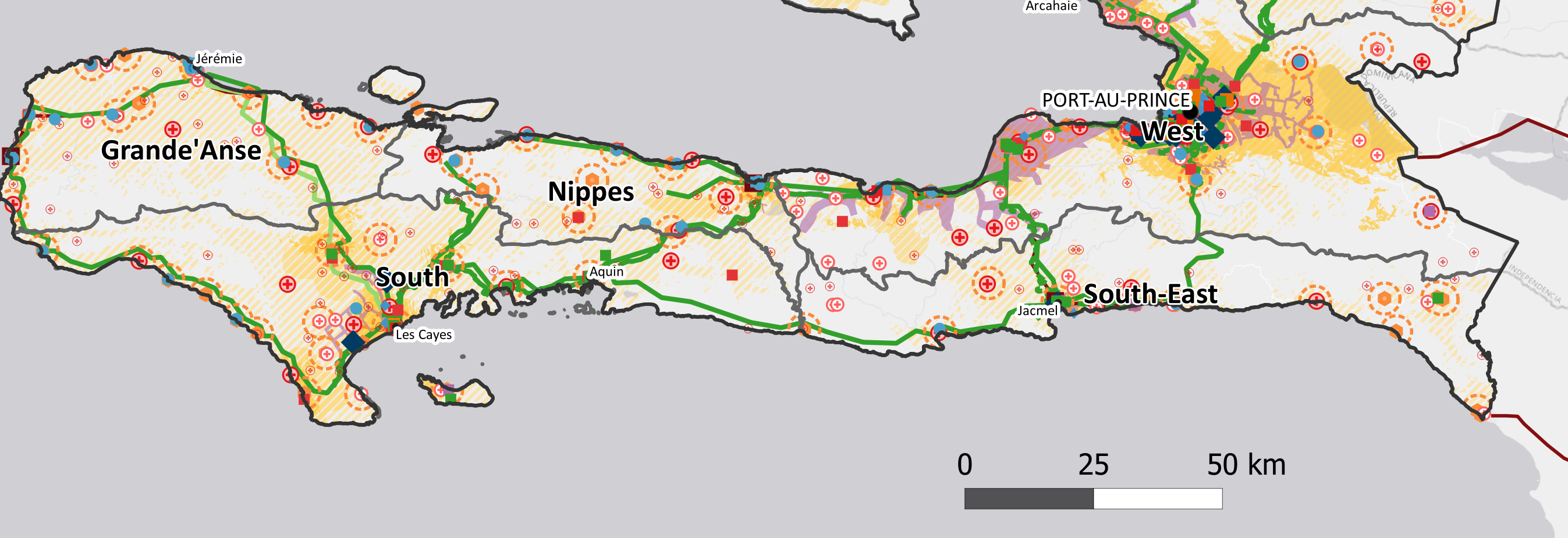
For an international funding institution, design of a national broadband backbone network, PPP options and digital services in Haiti
The study aimed at defining options to improve broadband connectivity in Haiti through 4 stages involving regulatory, socio-economic, financial and geospatial analysis:
- The evaluation of the enabling environment;
- The identification of connectivity gaps and network expansion solutions;
- The evaluation of the demand;
- The definition of the technical, economic and financial scope and implementation modality.
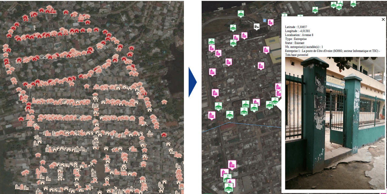
For a convergent Telecom Operator, Investment Strategy & Deployment Plan for a FTTH Network
The objective was to plan the Fiber Optic network deployment plans (FTTx) in Abidjan, Dakar and 8 regional capitals of Senegal.
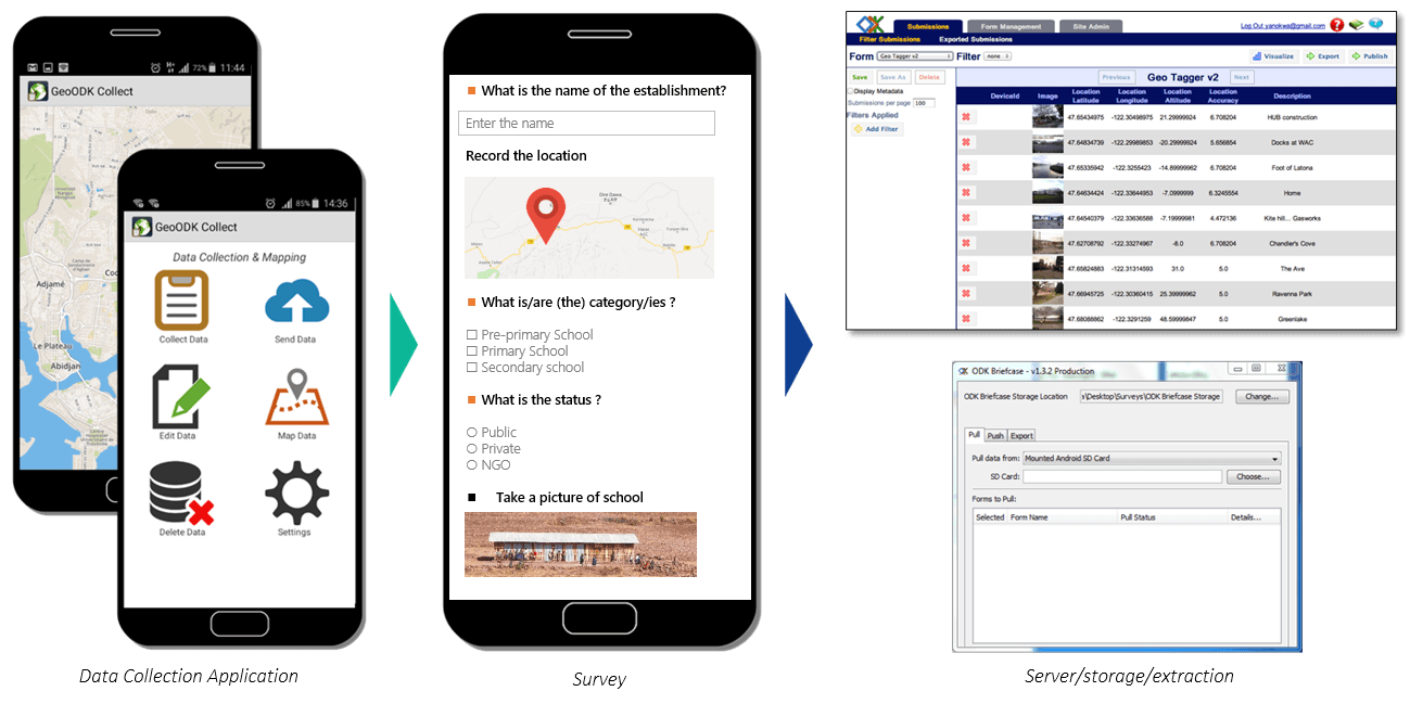
Comprehensive censuses of eligible residential and professional buildings (according to size and standing criteria) were conducted by teams of surveyors equipped with a smartphone equipped with a GPS, a camera and an application for entering a questionnaire. Thus, 35,000 eligible buildings were located in Abidjan, 200,000 in Dakar and 180,000 in the regional capitals currently being qualified.
The GIS allows to identify (photo) each building and to know its technical specifications and its commercial potential.
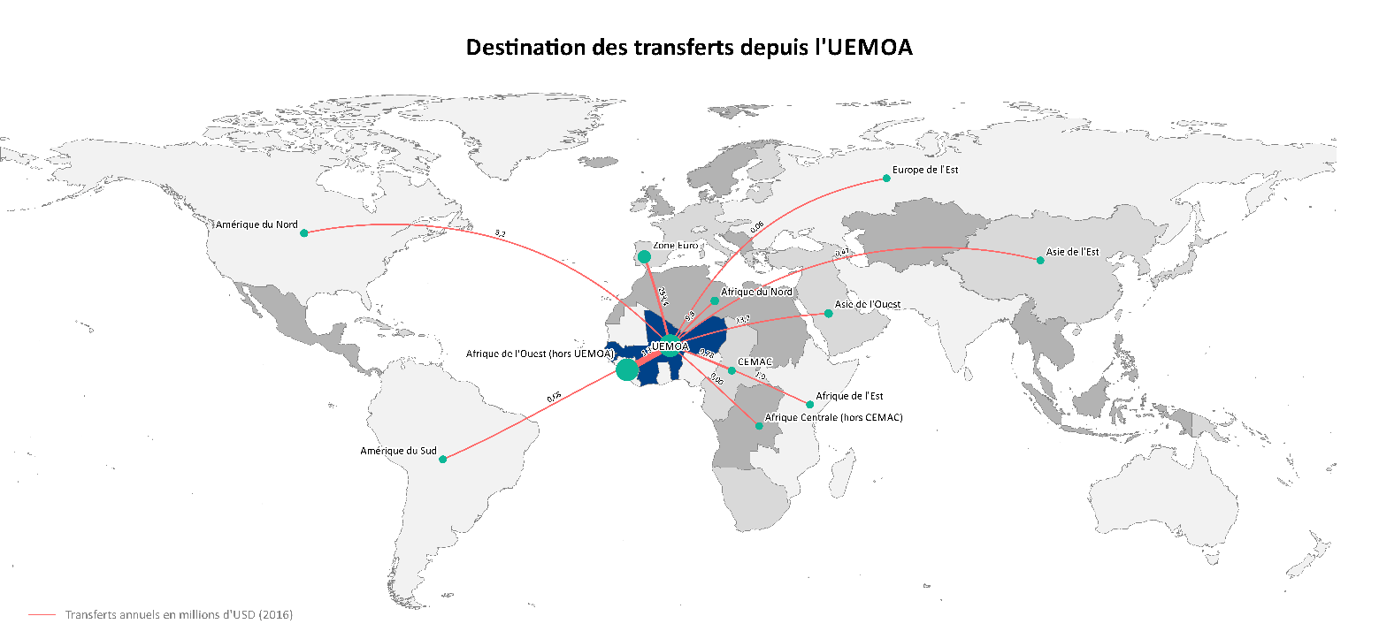
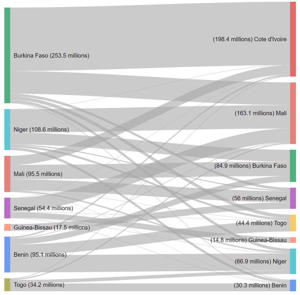
For an international funder, survey on opportunities and risks of the digitalization of money transfers in WAEMU and EMCCA countries
The objective was to identify and quantify the main national, regional and international money transfer corridors, analyze the regulatory environment, the growth potential and the risks involved, and propose technical, legal and financial measures to accelerate development without jeopardizing the security of States and beneficiaries.
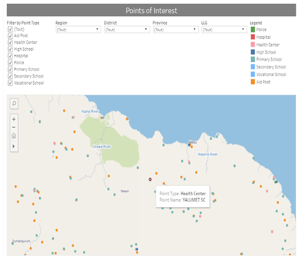
Define a national plan for connecting the Administration sites
The objective is to define the national plan for connecting the Administration sites (including schools and public health centers) to the national backbone.
After an exhaustive census, the geolocalisation (latitude, longitude), and the specification (size, staff, etc.) of 1,015 sites already connected, a five-year connection plan of 400 to 4,700 new sites was developed: technical survey of the solutions, calculation of economic and financial profitability of the program and network deployments planning according to several scenarios.
The new sites to be connected are distributed over the territory based on relevant data (population per km², activities, road network, etc.) and integrated into the GIS.
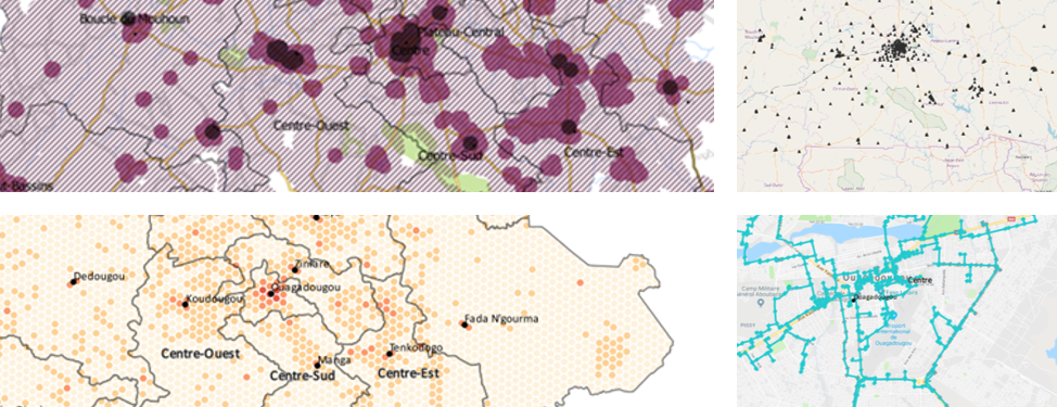
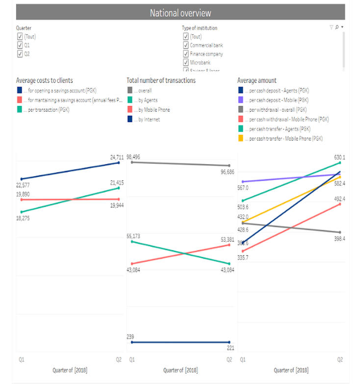
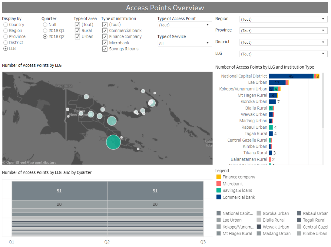
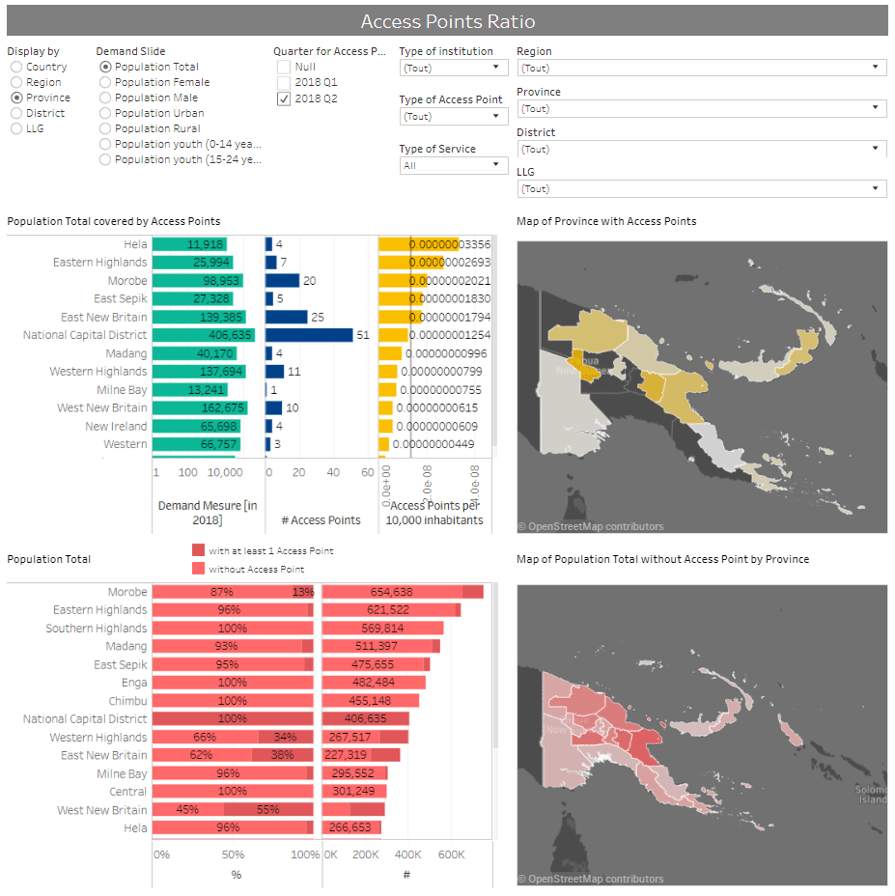
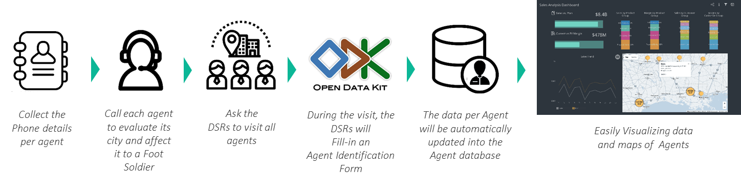
A financial inclusion mapping for a Financial Inclusion Center
The objective is to establish a map of financial services points throughout the territory.
Since an exhaustive field survey was not possible over a vas territory, questionnaires were sent to the various service providers and the data collected are integrated into a GIS. The deliverable will include 300 geo located sites (financial access points), 70 Key Performance Indicators visualized in more than 5 interactive dashboards (filters, zoom on map…) published on the web.
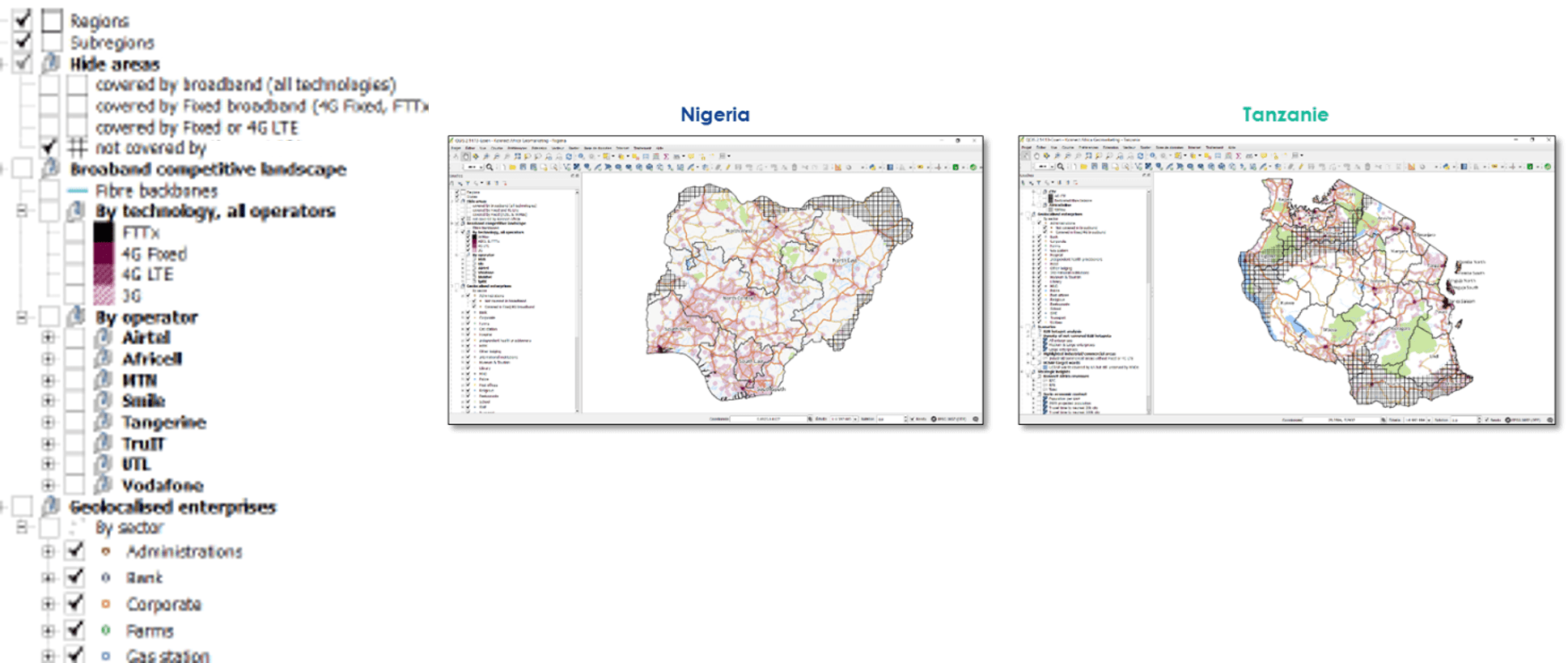
Satellite broadband services demand study in 10 African countries
The objective was to build a GIS as a marketing tool for satellite broadband services in 10 targeted countries (Cameroon, Côte d’Ivoire, DRC, Ghana, Kenya, Nigeria, South Africa, Senegal, Tanzania, and Uganda).
It was not possible to conduct comprehensive field surveys on such a large scale. Residential demand was distributed according to population per km² and household income levels. Using automated web scrapping techniques we were able to locate 390,000 professional hot-spots (B2B sites such as hotels, hospitals, restaurant, etc.). For each country, we delivered a complete GIS tool with a large set of layers.
Optimization of a financial services distribution network
The objective was to optimize a financial services distribution network (money transfer) in Zambia.
A GIS was built integrating the relevant socio-economic data and allowing the optimization of the agents’ network and their distribution on the territory as close as possible to demand.
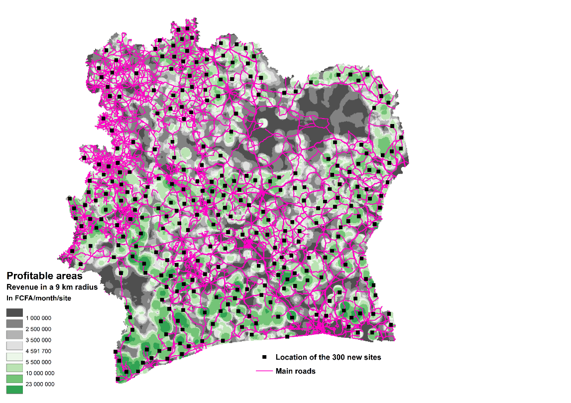
For a telecom operator, strategic study to support the roll-out of new radio sites
The objective is to map and analyze the coverage of the operator and its competitors in order to calculate coverage statistics (as a percentage of the territory, the population and the telecom potential) to highlight not covered areas with telecom potential. This accurate geographic analysis is an essential contribution to optimize the roll-out plan as it allows mapping the demand and positioning new sites in profitable areas.
Sector Expertise
Follow us on Linkedin